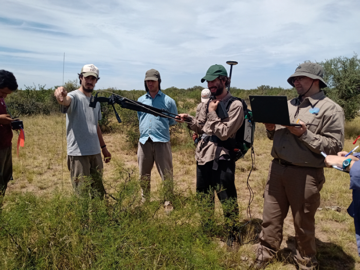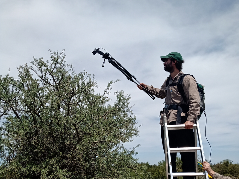
Space agency professionals carried out a field campaign in the Patagones district. With a radiometer they collected spectral signatures of the vegetation, to validate the satellite information, design an alarm system and a rational management of the pastures in the mountains. In 10 years, more than one million hectares burned in this region.
The National Commission for Space Activities (CONAE) and the National Institute of Agricultural Technology (INTA) are collaborating with other national and provincial institutions to implement an early warning system for fires in the Patagones district, the southernmost in the province of Buenos Aires. To advance this project, professionals from the Argentine space agency carried out a campaign from November 28 to December 2, 2022, with the aim of collecting spectral signatures, which represent the digital footprint of the land cover in the native forest. and a key input for the development of satellite products .
With this information collected in the field, added to that obtained by images from the Sentinel and Landsat satellites, they aim to more accurately characterize the vegetation cover of this ecosystem, calculate the fuel load and, combined with meteorological data, determine the risk of fires and develop early warnings. This system would help to implement a rational management of the native forest, emphasizing prevention . For example, the stocking rate could be increased so that the animals consume the vegetation at times of greatest risk, when dry periods are very pronounced and there are high temperatures in the summer season, from November to March.
Alejandro Pezzola , a professional from the Laboratory of Remote Sensing and Geographic Information Systems of the INTA Hilario Ascasubi Experimental Station, explained that the study region comprises 1.2 million hectares with a large area of native forest that, in dry seasons, is regularly affected by fires . “We have exceeded more than one million hectares burned in the last decade,” he lamented.
The trials are carried out in an experimental plot of 22 hectares of native forest that is characteristic of the Espinal ecosystem , designed together with the Ministry of Agrarian Development of the province of Buenos Aires, where different livestock practices are implemented. CONAE added to these studies a spectro – radiometer, which allows field measurements of the spectral response of the different plant covers, that is, their spectral signature .
“We want to have information on the land cover to determine the fuel load in risk situations (days with high temperatures and electrical storms, for example, in times of drought) and develop a fire alert system, available for decision-making. added Pezzola . “A forest with two tons of dry material will be more available for fire than one with less. If we have that information, we can adjust the handling. For example, increase or decrease the stocking rate on the pastures, to regulate the spread of fires”, he detailed.
The project also includes the collaboration of the Development Corporation of the Buenos Aires Valley of the Colorado River (CORFO), the National Geographic Institute and the Institute of Climate and Water of INTA Castelar, together with other departments of the institute such as the Experimental Station of the Lower Valley of Rio Negro and the Patagones Rural Extension Agency .
spectral signatures
The field campaign was made up of Pedro Rivolta and Sebastián Heredia, professionals from CONAE’s Technological Linkage Management, who collected spectral signatures from the different covers of the native forest, both shrubs (chañar, alpatacos and piquillín, among others) and of grasslands, with the use of a spectro-radiometer provided by the space agency.
Spectral signatures are reflectance values (the ability of a body to reflect light), unique for each of the land covers . “It is the energy that the crop reflects at the different wavelengths of the spectrum ,” Rivolta exemplified, although he clarified that it is also applied to measure minerals or types of soil, among other materials. It is “the fingerprint” of each coverage, he considered.
Heredia added that the values obtained from this field work will serve to calibrate and validate new products based on satellite images . “The idea is to link the data that we are measuring on Earth with what the satellites observe , to classify the forest species and then quantify the fuels using satellite images,” he reported.
Pezzola indicated that, in the future, information from the Argentine SAOCOM satellites could be incorporated into the studies. “We have already received the proposal to add information from radar satellites to these works, which would also allow us to measure the humidity of the vegetation ,” he said.